The development of science and technology has led to changes in various industries in many ways. Agriculture has been modernizing to increase production and maximize productivity.
Precise agricultural: Agricultural Innovation
For centuries farmers have walked their fields monitoring the health of their crops. It is a time-consuming process. But this is changing.
Agriculture drones are becoming a key of innovation: Helping farmers automate crop spraying and seeding, monitor, and inspect crop growth and improve farming efficiency, leading to increased outputs and maximizing productivity.

How agricultural drones are transforming agriculture
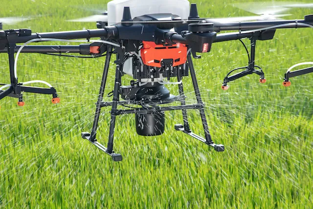
Crop spraying drones – Automated and precise.
Agricultural drone spraying is becoming an increasingly popular application, helping to maintain crop health and yields.
Drones are being deployed for spraying for disease, weed, and pest control, as well as spreading pesticides and fertilizers.
Using drones for this application makes sense, offering a fully-automated, targeted and precise solution.
Especially, this method is particularly useful in areas, where the terrain is undulating, steep, or hard to access. Drones integrate centrifugal spray nozzles to help spray precisely, to both sides of leaves.
Crop inspection drones – Accurate and quick
Crop inspection is a vital part of farming and a drone can be deployed to capture fast, and accurately. Drones can carry an FPV camera with an adjustable pan/tilt angle that captures images of farms in real-time.

This provides vital real-time insights about crop growth, helping to quickly identify problems to provide the solution in time.
Agriculture Mapping Drones – High-resolution
Drone mapping provides better insights into crops from above. Drone mapping also provides the chance to set pre-determined flight paths for autonomous missions.

Drone mapping can provide the following insights:
- Field Inspection: Identify issues with high-resolution maps.
- Irrigation: Manage irrigation and minimize soil erosion by creating a digital surface model. This helps farmers understand irrigation variability and highlight areas at risk of erosion.
- Field Condition: Analyse different vegetation index maps to identify key crop areas that need to be addressed.
- Historical Analysis: Compare side-by-side maps to track a crop’s progress over time.
In conclusion, with their superior features, agricultural drones can be the solution to change traditional farming to increase efficiency and crop productivity.